Residents of our local intake area (Lynwood and Ferndale) are eligible to enrol their children at Bannister Creek Primary School. Please complete an Application for Enrolment form by clicking on the following link Application for Enrolment Form
The form needs to be returned to our School Office, along with your child's birth certificate, proof of address such a utility bill with your name, address and a current date, your child's Medicare immunisation record and any other relevant documents such as court orders, visas etc.
Applications will be reviewed by our Principal and you will be contacted to complete the enrolments procedures.
Local Intake Area
The local intake area for this school is displayed on the map below:
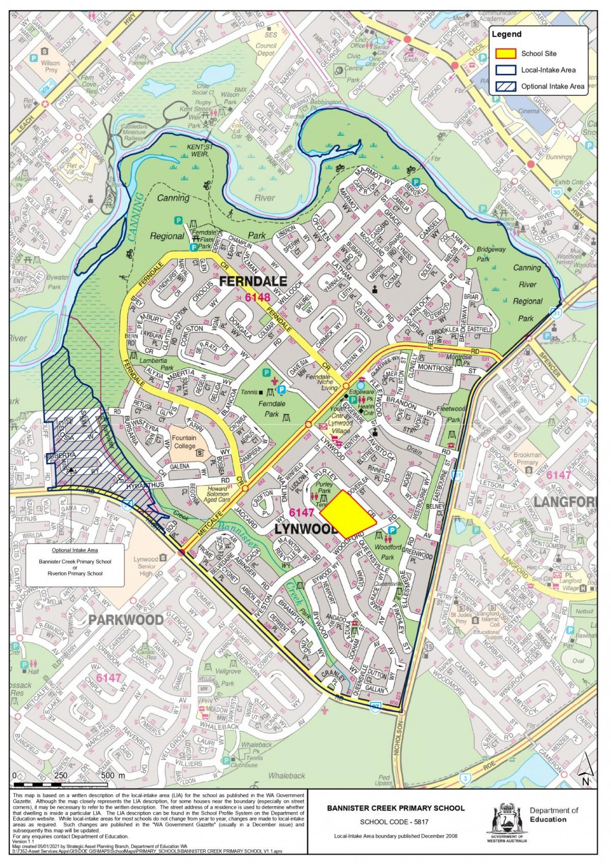
The following defines the local-intake area of Bannister Creek Primary School
From the junction of High Road and Nicholson Road, north and north-east along Nicholson Road to the Canning River, generally north-west and south-west along the Canning River to Bannister Creek, south east along Bannister Creek to the bike path, continuing south east along the bike path to Bold Place, south west along Bold Place to High Road, and south-east along High Road to Nicholson Road. The boundary parts of Nicholson Road (west side), Bold Place (both sides) and High Road (north east side) are included within the local-intake area for Bannister Creek Primary School.
The following defines an optional area between Bannister Creek Primary School and Riverton Primary School:
From the junction of Duff Road and High Road, north along Duff Road and its northerly extension to the Canning River, east along the Canning River to Bannister Creek, south east along Bannister Creek to the bike path, continuing south east along the bike path to Bold Place, south west along Bold Place to High Road, and north west and west along High Road to Duff Road. The boundary parts of High Road (north side) are included within this optional area. The boundary parts of Duff Road (both sides) and Bold Place (both sides) are excluded from this optional area.
NOTE
The local-intake area maps are based on a written description of the local-intake area (LIA) for the school as published in the WA Government Gazette. Although the map closely represents the LIA description, for some houses near the boundary (especially on street corners), it may be necessary to refer to the written description. The street address of a residence is used to determine whether that dwelling is inside a particular LIA. While local-intake areas for most schools do not change from year to year, changes may be made to local-intake areas as required. Such changes are published in the WA Government Gazette and subsequently the local-intake area map will be updated.